While poking about on the net looking for related info, I discovered "benchmarking." It's related to geocaching in that a GPS receiver is used, but the targets are a little different. They are benchmarks placed by surveyors that were formerly used for tying survey data into the global reference framework. I say "formerly," because modern electronics have rendered them mostly obsolete. But I love a good anachronism, not to mention the challenge of finding something that was placed decades ago and largely ignored since then.
Today during my lunch hour I logged this one:
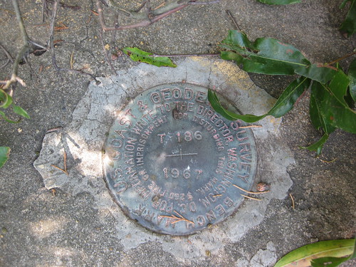
It's located in the concrete abutment on the west side of the Erwin Road railroad bridge. It's at approximately N 36° 00' 23" W 78° 55' 20" and precisely 417.63 feet above sea level. It was placed there by the National Coast and Geodetic Survey in 1967, and the last documented "recovery" was by the US Power Squadron in 1989.
That one was relatively easy. I have a list of others that will be more of a challenge. I'll post more as I find them (or try to find them).


